
Hike&Fly Tracking [BETA] — paragliding flight tracking in the Sidekik app
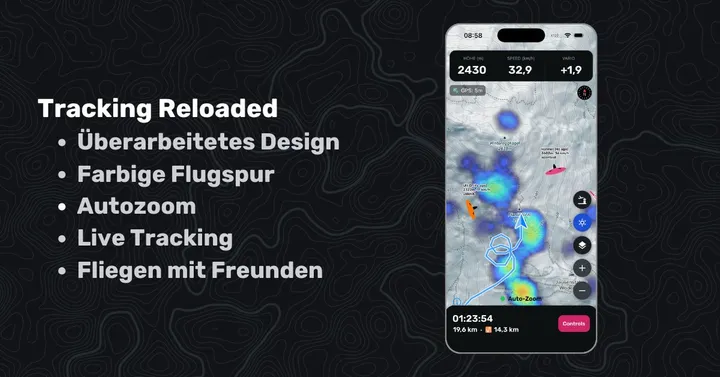
“Sidekick” is another word for “wingman”. Sidekik is there to support, motivate and guide you on your paragliding adventures. That vision is a step closer today — with the beta launch of Hike&Fly tracking, right in the app.
Support in the air
Tracking starts with a set of functions that help your flying and your Peak Hunt challenges.
Challenge peaks on the map
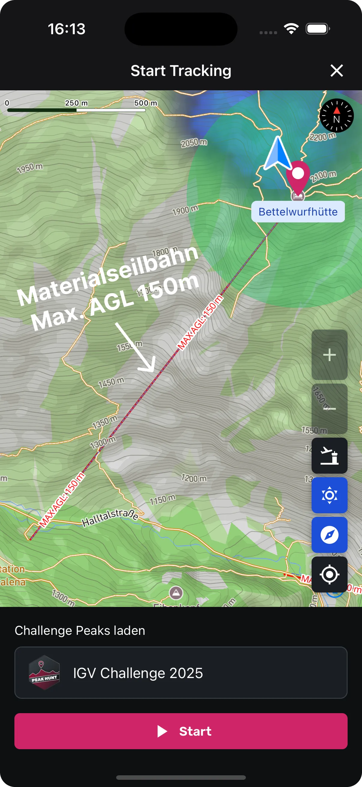
Challenge waypoints (peaks) are visible on the map — including the radius and automatic zoom when you get close. You see the current distance and the closest you have come to that peak on this flight.
Obstacles on the map
Safety first: the new map shows potential obstacles such as power lines and cable cars. You can plan a better line and, in the air, see what is ahead. (Data: https://airspace.xcontest.org/)
See where it (probably) goes up
With KK7 thermal maps you see at a glance where lift is most likely — based on real user data from more than three million XC flights (data: https://thermal.kk7.ch/).
Airspace
To help you stay clear of airspace, you can sync current airspace and show it on the map. (Data: https://www.openaip.net/)
XC distance
Other iOS flying apps often miss this, and it always motivated me in the air (when I used XCTrack), so it is there from day one. Every 30 seconds the current XC distance is calculated and shown (including whether it is a free distance, a flat triangle or an FAI triangle). To save battery it can differ slightly from the XContest calculation.
Also
Privacy
You only need to give Sidekik location access while using the app. We do nothing in the background — if the app is closed, it is closed.
Offline mode
If you have no internet when you finish the track, the flight is stored on the device. Next time you connect, it syncs automatically.
What is on the roadmap
- Improve and stabilise tracking
- Full offline mode (preload maps and challenges)
- IGC export of signed IGC files (upload to XContest / DHV XC)
- “Thermal assistant” and wind calculation
- Live wind values
- Livetracking
- Route planning in the app
If you have ideas, or miss a function you use in other apps, write to me ([email protected]).